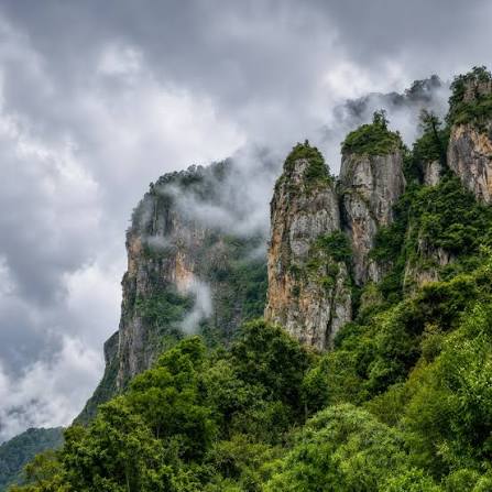
Suppose the hill has 5km radium base and the height being 1km, the volume would be ~2.6x10^10 m3. A rock density being from 2700 to 3000 kg/m3, and selecting 2700 kg/m3 for our purpose, the mass of the mountain comes out to be 7.06x10^13 kg. Now this mass gets carried away by constant flowing streams of rivers but how much of flows out? I think we should get some hydrodynamics here. But before that lets define some approximate constants. The average speed of a river on an 11.5* inclination be 4 m/s.

(source google images: https://cwseducation.ucdavis.edu/class/106/synergy-rocks-rafts-and-rivers-brief-primer-hydrodynamics)

(source: google images: https://www.researchgate.net/figure/Schematic-representation-of-sediment-transport-model-a-Diagram-showing-the-river-load_fig1_362519428)
So, to calculate erosion rate, we have 3 formulas. But let's try the universal soil loss equation, which is:
A = R x K x L x S x C x P
A = Annual soil loss per unit area
R = factor dependent on amount of rainfall
K = erodibility factor dependent on type of soil
L = Length of slope
S = Steepness of slope (we already have the angle of inclination with us)
C and P not required in our case because that applies to crop and farmlands only.
Suppose our mountain is in the Kodaikanal region in Tamil Nadu, then the R based on studies is 74.60 mm/ha
K is 0.49 for forest type of soil
L is length of slope that needs to be calculated using the formula:
L = (sigma/22.13) ^0.5, where sigma is hillslope length.
So, in our case 100m of slope length if consider at a steepness angle of 11.5*, that comes to 2.125
S is the steepness factor which can be calculated using the formula:
S = 16.8 x sin (theta) - 0.50
S = 16.8*sin (11.5) - 0.50
S = 2.849
So, L.S factor is 6.054
Now the annual soil loss per unit area comes to 221.29 metric tons per hectare per year.
But coming to the main question that where does all of this accumulate. Now since the steepness of our mountain is high and the speed of the river given the steepness is also high, when the river comes down to a flat plane from above, it forms an Alluvial Fan

(source: google images: https://adisclasses.in/site-tree/upsc/geo-concepts/what-are-alluvial-fans/)
All that accumulated soil gets heavy dumped by the streams at the mouth of the mountain forming a debris cone. These are dangerous because when there is flooding from the mountains, all of this loaded debris is carried by the flood and that's one of the reasons why the Nepal Floods were so deadly.
Okay it seems like we have ended our run for solving the question successfully. But now comes an ending point that we need to think about. If the erosion rate annually ranges between 200 to 250 metric tons per hectare per year, how do mountains in the Himalayas or Mahendra Giri exist after millions of years? The starting point for this run is the word "Plate Tectonics" and since in our case we considered a mountain in Kodaikanal, which is in South India having a stable plate and least earthquake activity, how does it exist after millions of years now?
Perhaps the realistic picture of the question and phenomenon is non quantifiable but knowing this was a good starting point.
References:
1. https://cwseducation.ucdavis.edu/class/106/synergy-rocks-rafts-and-rivers-brief-primer-hydrodynamics